File:NederlandProvincie.jpg

没有更高的分辨率。
NederlandProvincie.jpg (462 × 568像素,文件大小:90 KB,MIME类型:image/jpeg)
摘要
| 描述 |
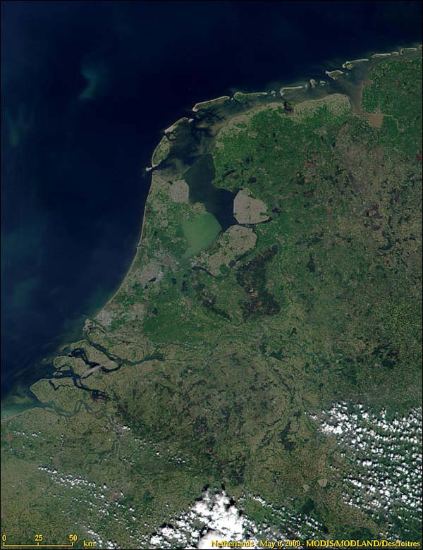
Nederlands: Nederland en de indeling in provincies.
Samengesteld door Ed Stevenhagen 13 jul 2005 17:14 (CEST) Satellietopname: Nederland uit de ruimte van modis.gsfc.nasa.gov/MODIS/IMAGE_GALLERY/MODIS1000097_md.jpg NASA Terms of Use For all non-private uses, NASA's Terms Of Use are as follows:
Visible Earth Addendum Beyond the NASA Terms, the Visible Earth team requests, but does not require:
|
| 日期 | 2005年7月13日 (原始上传日期) |
| 来源 | Transferred from nl.wikipedia |
| 作者 | Original uploader was Ed Stevenhagen at nl.wikipedia |
| 授权 (二次使用本文件) |
This image is in the public domain; PD-NASA. |
许可协议
| 本文件完全由NASA创作,在美国属于公有领域。根据NASA的版权方针,NASA的材料除非另有声明否则不受版权保护。(参见Template:PD-USGov/zh、NASA版权方针页面或JPL图片使用方针。) | ||
 |
警告:
|

|
一旦在圖像本身中可見的文本信息(例如時間戳)已移動到圖像元數據和/或圖像描述頁面。 這使圖像更易於重用且更不依賴語言,並使文本更易於處理和搜索。共享資源勸阻在圖像中放置可見的文本信息。共享資源接受的所有許可證都允許將這種類型的修改作為衍生作品進行。
如果屬性信息被刪除並且圖像不是公共領域,請將此標記替換為{{Attribution metadata from licensed image}}。
|
原始上传日志
原始描述頁面位於這裡。下列使用者名稱均來自nl.wikipedia。
- 2006-01-22 22:39 Ed Stevenhagen 462×568×8 (74968 bytes) Zie oorspronkelijke beschrijving. Aanpassing Markerwaard
- 2005-07-13 15:14 Ed Stevenhagen 462×568×8 (168190 bytes) Nederland en de indeling in provincies. Samengesteld door ~~~~ Satellietopname: Nederland uit de ruimte van [http://modis.gsfc.nasa.gov/MODIS/IMAGE_GALLERY/MODIS1000097_md.jpg modis.gsfc.nasa.gov/MODIS/IMAGE_GALLERY/MODIS1000097_md.jpg] NASA Terms of Use
文件历史
点击某个日期/时间查看对应时刻的文件。
| 日期/时间 | 缩略图 | 大小 | 用户 | 备注 | |
|---|---|---|---|---|---|
| 当前 | 2008年8月4日 (一) 03:24 | | 462 × 568(90 KB) | Jarekt | Removed 4 watermarks |
| 2008年8月3日 (日) 05:02 |  | 462 × 546(74 KB) | Jarekt | {{Information |Description=removed watermark |Source= |Date= |Author= |Permission= |other_versions= }} | |
| 2008年3月6日 (四) 08:30 |  | 462 × 568(73 KB) | File Upload Bot (Magnus Manske) | {{BotMoveToCommons|nl.wikipedia}} {{Information |Description={{nl|Nederland en de indeling in provincies. Samengesteld door Ed Stevenhagen 13 jul 2005 17:14 (CEST) Satellietopname: Nederland uit de ruimte van [http://modi |
文件用途
以下页面链接到本图像:
全域文件用途
以下其他wiki使用此文件:
- nl.wikipedia.org上的用途