File:People's Republic of China (no claimed territories).svg

此SVG文件的PNG预览的大小:541 × 541像素。 其他分辨率:240 × 240像素 | 480 × 480像素 | 768 × 768像素 | 1,024 × 1,024像素 | 2,048 × 2,048像素。
原始文件 (SVG文件,尺寸为541 × 541像素,文件大小:498 KB)
.svg?uselang=zh)
.svg?uselang=zh)
.svg?action=history&uselang=zh)
.svg)

|
这张图片需要更新,因为:South Sudan should be included in this map.在这样做的时候,您可以为该图片加入时间戳。
|
| 描述 |
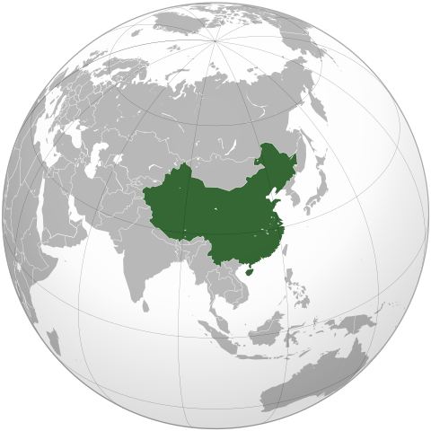
English: The People's Republic of China (green). |
| 日期 | (UTC) |
| 来源 | |
| 作者 |
|
| 其他版本 | 此文件衍生的作品: Battle of Red Cliffs 208 map-fr.svg |
.svg)
| 这是一张修改过的图片,这意味着它已在原版本的基础上通过软件进行了编辑,改动内容:Removed the claimed territories, showing only controlled territory。其原始版本为:People's Republic of China (orthographic projection).svg。修改者: Uirauna。
|
我,本作品著作权人,特此采用以下许可协议发表本作品:
- 您可以自由地:
- 共享 – 复制、发行并传播本作品
- 修改 – 改编作品
- 惟须遵守下列条件:
- 署名 – 您必须对作品进行署名,提供授权条款的链接,并说明是否对原始内容进行了更改。您可以用任何合理的方式来署名,但不得以任何方式表明许可人认可您或您的使用。
- 相同方式共享 – 如果您再混合、转换或者基于本作品进行创作,您必须以与原先许可协议相同或相兼容的许可协议分发您贡献的作品。

|
已授权您依据自由软件基金会发行的无固定段落及封面封底文字(Invariant Sections, Front-Cover Texts, and Back-Cover Texts)的GNU自由文件许可协议1.2版或任意后续版本的条款,复制、传播和/或修改本文件。该协议的副本请见“GNU Free Documentation License”。 |
|
|
已授权您依据自由软件基金会发行的无固定段落及封面封底文字(Invariant Sections, Front-Cover Texts, and Back-Cover Texts)的GNU自由文件许可协议1.2版或任意后续版本的条款,复制、传播和/或修改本文件。该协议的副本请见“GNU Free Documentation License”。 |
您可以选择您需要的许可协议。
该地图是使用通用制图工具创建的: https://www.generic-mapping-tools.org/ 使用其中一个或多个公有领域浮雕数据集:
|
|
|
已授权您依据自由软件基金会发行的无固定段落及封面封底文字(Invariant Sections, Front-Cover Texts, and Back-Cover Texts)的GNU自由文件许可协议1.2版或任意后续版本的条款,复制、传播和/或修改本文件。该协议的副本请见“GNU Free Documentation License”。 |
原始上传日志
This image is a derivative work of the following images:
- File:People's_Republic_of_China_(orthographic_projection).svg licensed with Cc-by-sa-3.0,2.5,2.0,1.0, GFDL, GFDL-GMT
- 2009-02-16T20:43:19Z [[User:Shib] 541x541 (492315 Bytes) Reverted to version as of 01:23, 14 February 2009
- 2009-02-16T16:53:16Z Uirauna 541x541 (510234 Bytes) Reverted to version as of 17:30, 9 February 2009 to reflect the NPOV rules, claimed territories should not be marked light green in the map
- 2009-02-14T01:23:58Z Shibo77 541x541 (492315 Bytes) ..
- 2009-02-14T01:09:04Z Shibo77 541x541 (488887 Bytes) Reverted to version as of 01:10, 27 October 2008
- 2009-02-09T17:34:05Z Uirauna 541x541 (510234 Bytes) Sorry, I uploaded the wrong file, this is the correct one.
- 2009-02-09T17:30:31Z Uirauna 541x541 (510234 Bytes) According to the [[Wikipedia:Neutral point of view]] rules, I have removed the light green marks over the regions claimed by PRC but controlled by other nationas, such as Taiwan and Arunachal Pradesh. Other country maps ( suc
- 2008-10-27T01:10:00Z Ssolbergj 541x541 (488887 Bytes) {{Information |Description={{en|1=The People's Republic of China (green) and its claimed territory (lighter green).}} |Source=as |Author=~~~ |Date=27 October 2008 |Permission= |other_versions={{DerivativeVersions|Battle of Red Cliffs 208 map-fr.svg}} }} [[Category:Maps of China]]
Uploaded with derivativeFX
文件历史
点击某个日期/时间查看对应时刻的文件。
| 日期/时间 | 缩略图 | 大小 | 用户 | 备注 | |
|---|---|---|---|---|---|
| 当前 | 2021年3月16日 (二) 21:48 | | 541 × 541(498 KB) | Geographyinitiative | Reverted to version as of 22:28, 16 February 2009 (UTC) It is better to have the admitted inaccuracy of not including South Sudan, which is secondary to the purpose of this image, than to include unusual & mysterious light and dark green circles along the coastline of the Asian mainland in the water implying some kind of territorial jurisdiction not explained in the description of the image. |
| 2013年8月4日 (日) 12:39 |  | 553 × 553(289 KB) | Flappiefh | Added South Sudan. | |
| 2009年2月16日 (一) 22:28 |  | 541 × 541(498 KB) | Uirauna | {{Information |Description={{en|1=The People's Republic of China (green).}} |Source=*File:People's_Republic_of_China_(orthographic_projection).svg |Date=2009-02-16 22:22 (UTC) |Author=*[[:File:People's_Republic_of_China_(orthographic_projection).svg |
.svg)
文件用途
没有页面链接到本图像。
全域文件用途
以下其他wiki使用此文件:
- ar.wikipedia.org上的用途
- en.wikipedia.org上的用途
- uz.wikipedia.org上的用途
.svg)